Area B

In this area the slope of the mound is very gentle, and therefore this area included the main city-gate throughout its existence. The field is divided to two sub-areas: B1 comprises the actual city-gate and everything to the north of it, B2 is to the south of the gate. As different periods were excavated in each of these sub-areas, we will describe them here separately.
Area B1
Iron Age
1 - 2a strata (local stratigraphy: Phases 13-8), were found here under a set of later
(Iron Age 2 - Roman) gates and fortifications.
Overview
Area B2
Excavation
1980 - 1995 by California State University, Sacramento (dir. Howard P. Goldfried).
Stratigraphic sequence
Roman Period
 Local phases 1-2 (strata I-II):
This area was almost exclusively concerned with the
Roman period.
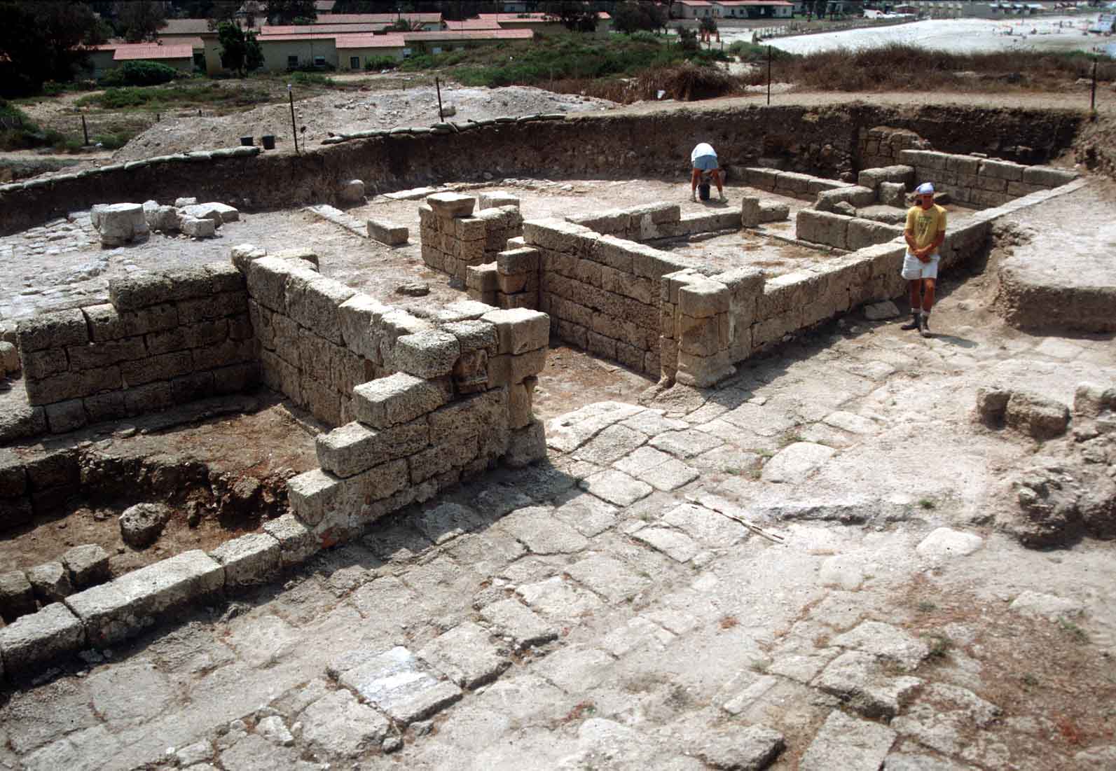
Large tracts of the entrance to the [upper] city and regions to the west and south
of it were uncovered.
In this period, the mound was unfortified. As the city had grown by then to
incorporate a lower town beyond the tell, such a fortification would have been
superfluous. Over the old
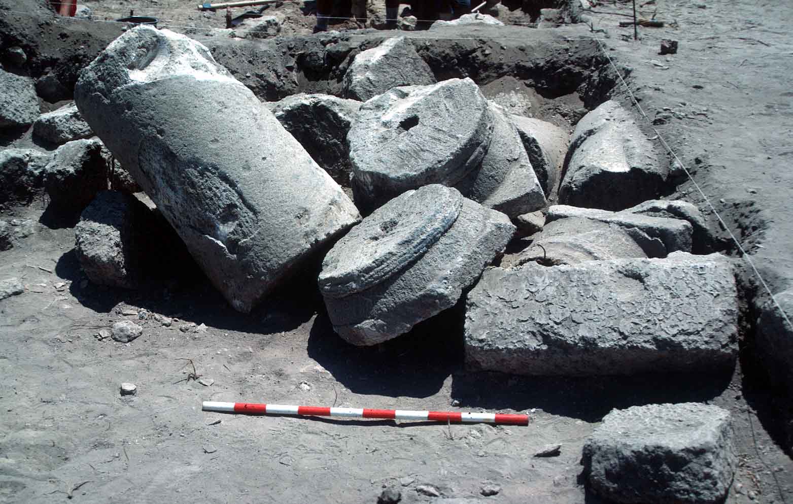
Hellenistic wall and gate
a wide, open 'piazza' was built. Several column drums found on the
pavement may indicate a colonnade around this piazza - much like
the entrance to contemporary Gerasa. Two of the main streets of the
city intersect in this piazza. 'Street I' leads from the piazza
northwards, and was followed through areas
B1,
A and
C. On the opposite (south)
end of the piazza, the same street continues toward the southern harbor.
Local phases 1-2 (strata I-II):
This area was almost exclusively concerned with the
Roman period.
Large tracts of the entrance to the [upper] city and regions to the west and south
of it were uncovered.
In this period, the mound was unfortified. As the city had grown by then to
incorporate a lower town beyond the tell, such a fortification would have been
superfluous. Over the old
Hellenistic wall and gate
a wide, open 'piazza' was built. Several column drums found on the
pavement may indicate a colonnade around this piazza - much like
the entrance to contemporary Gerasa. Two of the main streets of the
city intersect in this piazza. 'Street I' leads from the piazza
northwards, and was followed through areas
B1,
A and
C. On the opposite (south)
end of the piazza, the same street continues toward the southern harbor.
 At the west end of the piazza starts the main E-W street, or decumanus of the city. The
same street was traced through to area G,
in the center of the mound, where it intersected by the main N-S street - the
cardo, and probably went all the way to the main gate of the temple in
area F.
At the west end of the piazza starts the main E-W street, or decumanus of the city. The
same street was traced through to area G,
in the center of the mound, where it intersected by the main N-S street - the
cardo, and probably went all the way to the main gate of the temple in
area F.
South of the gate piazza, and east of street I, was found a large Peristyle house.
Wheelmarks in the wide entryway to this structure indicate that carts or chariots were
driven from the street into the peristyle and vice versa.
Thus this structure may have been used as an inn or perhaps as barracks. Opposite it,
on the west side of the street, are foundations to a very similar structure.
To the latter structure was added, in phase 1, another peristyle (or perhaps a
basilical hall) with an opus-sectile floor. Finally, at the
intersection of street I
with the decumanus, was a long structure that might have been a stoa.
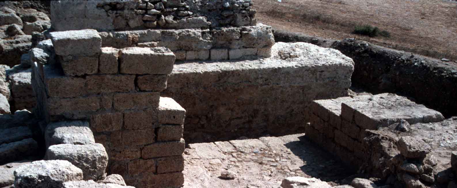 Also remarkable for this area are the various Roman water-systems.
Just south of the city-gate and piazza was the terminus of an aqueduct. It brought
fresh water from springs at Bir Tata, some 12 km. to the east, in the Wadi Milh pass
through the Carmel range.
At the terminus is a solid concrete foundation, possibly for a 'Castelum'
(water-tower) - from which water was distributed throughout the city
in clay pipes. Also found, underneath the decumanus, was the
central sewer (Cloaca Maxima) draining out of the city.
Also remarkable for this area are the various Roman water-systems.
Just south of the city-gate and piazza was the terminus of an aqueduct. It brought
fresh water from springs at Bir Tata, some 12 km. to the east, in the Wadi Milh pass
through the Carmel range.
At the terminus is a solid concrete foundation, possibly for a 'Castelum'
(water-tower) - from which water was distributed throughout the city
in clay pipes. Also found, underneath the decumanus, was the
central sewer (Cloaca Maxima) draining out of the city.
Hellenistic Period
 Local phases 3-4: In the Hellenistic period
there was no 'piazza', though both street I and the decumanus date
back at least to this era
(see plan).
South of the gate (and under the Roman peristyle house) the city-wall turned east and
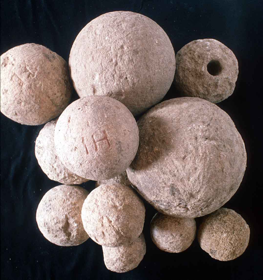
then south again, so as to include within the fortifications a massive structure -
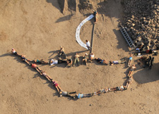
probably a gate-bastion. A concentration of several dozens
catapult stones of various
diameters was found here.
Local phases 3-4: In the Hellenistic period
there was no 'piazza', though both street I and the decumanus date
back at least to this era
(see plan).
South of the gate (and under the Roman peristyle house) the city-wall turned east and
then south again, so as to include within the fortifications a massive structure -
probably a gate-bastion. A concentration of several dozens
catapult stones of various
diameters was found here.